The FIRECOM project
The FIRECOM project was developed by Axtron Systems as part of the EU Horizon CHAMELEON project. Its main objective is to use drones and artificial intelligence to help reduce the risk of wildfires spreading in urban-forest interfaces.
The project created a tool that uses drones to capture high-resolution aerial imagery of designated areas, and then automatically determines safe buffer zones around buildings and roads, where trees and vegetation density should be managed.
Click on the next image to watch a video on youtube about the project
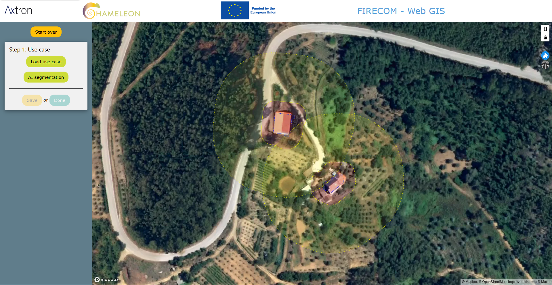
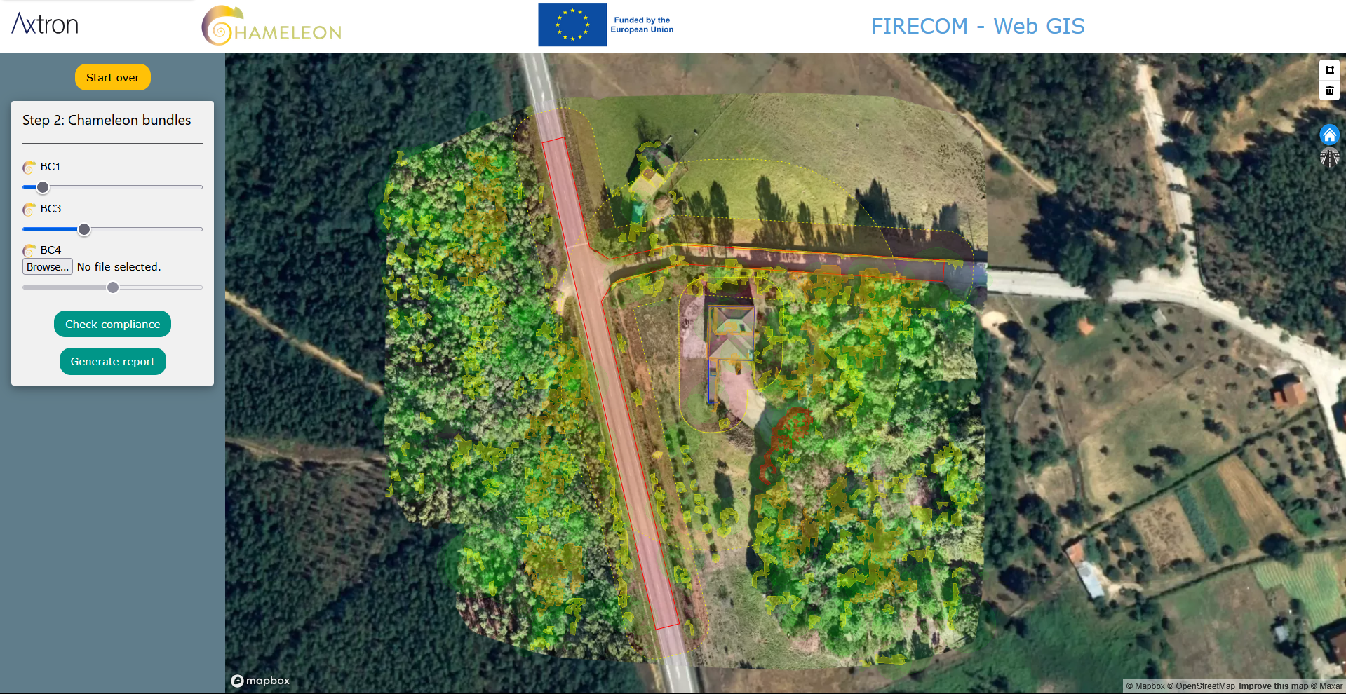
The system uses AI (Convolutional Neural Networks) to automatically detect the contours of buildings and create buffer zones around them. In the following image, the two buffer zones (10m and 50m from buildings) are determined by Portuguese legislation. These two buffer zones have different requirements regarding management of trees and vegetation.
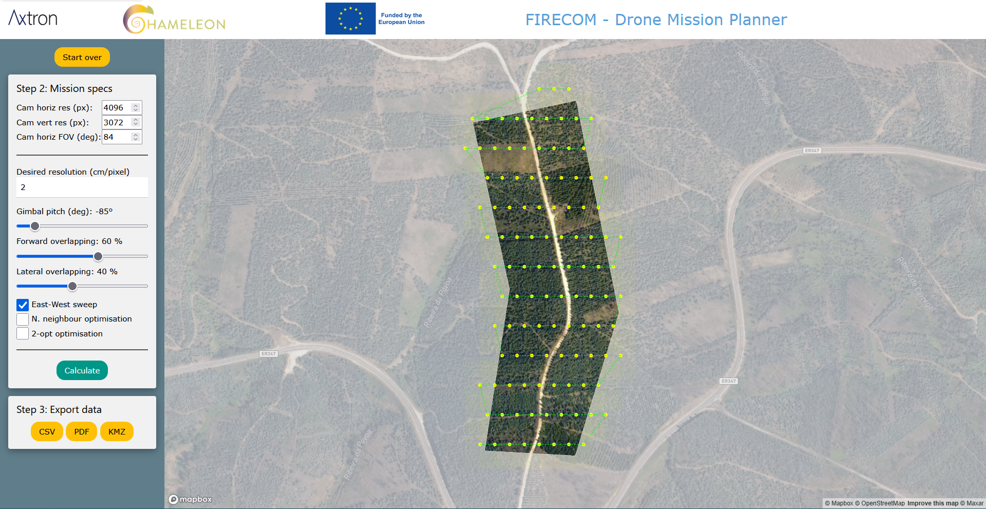
The mission planner module allows creating capture missions. The user can define several parameters related to the drone’s camera, namely the horizontal and vertical resolution, its field of view (FOV) and the gimbal pitch. The user can also define the parameters related to the chameleons' bundle’s requirements regarding the images, specifically resolution in cm/pixel, forward overlapping, and lateral overlapping. The module then calculates and shows the waypoints where images must be captured to comply with the required parameters. The path is initially calculated as a simple east-west linear sweep that embraces the designated area, but it can be further optimized using a nearest neighbour algorithm, followed by a 2-opt optimization algorithm. These waypoints can then be saved in CSV, PDF and KMZ format (WPML) so that they can be exported to KMZ compatible drones (such as some DJI drones), allowing automated mapping operations.
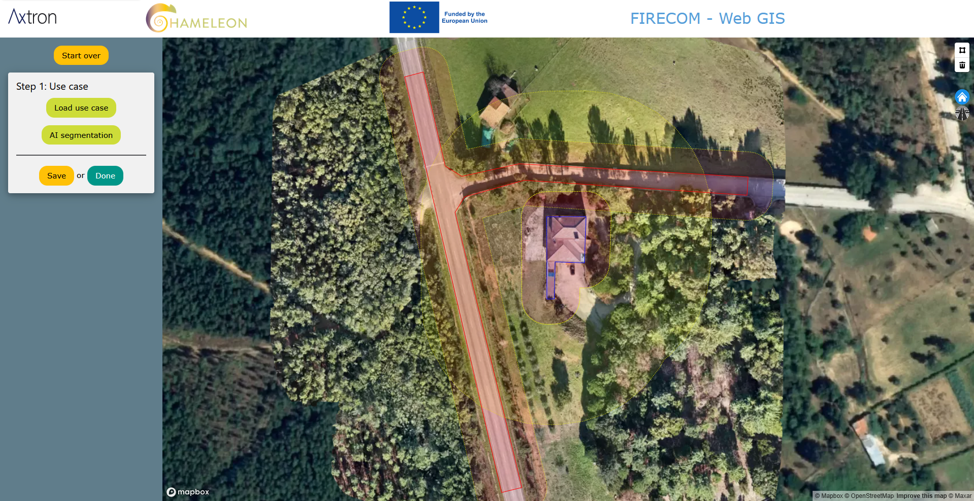
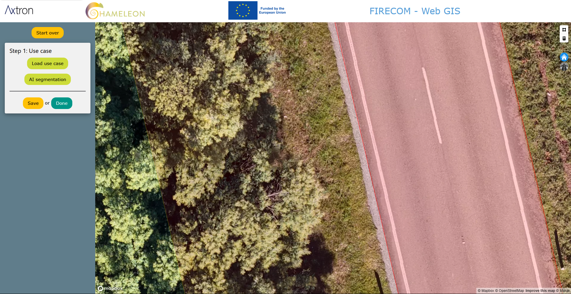
The following image shows a use case with buffer zones around a building and also a road.
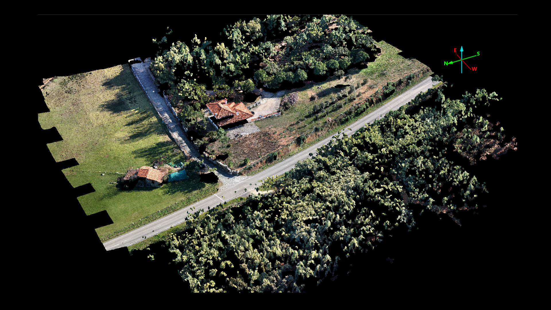
The use of drones makes it possible to create high-resolution orthophotos, with centimeter-level resolution, as can be seen in the following image.
The system is able to create 3D representations of the field, which are needed by the chameleon bundles to extract information about the trees, the density of vegetation and other valuable information.
The system is able to integrate the output of the chameleon bundles into the use-case, to determine the existence of trees and vegetation inside the buffer zones, which must be cut down to comply with the legislation.
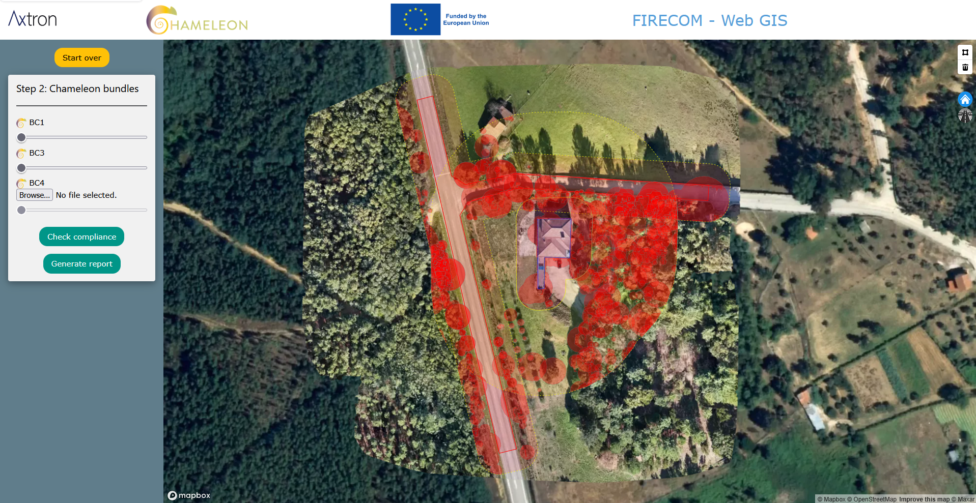
The next image shows (in red) the trees and vegetation that must be cut down, to comply with the legislation.
The FIRECOM project has indirectly received funding from the European Union’s Horizon Europe research and innovation action programme, via the CHAMELEON Open Call #2 issued and executed under the CHAMELEON project (Grant Agreement no. 101060529).